The Arkansas Department of Transportation and a University of Arkansas geotechnical engineer have partnered to use technology to map subsurface conditions before road construction begins. The goal is to identify problems early and help keep projects on budget and schedule.
Projects encountering problems can experience delays while designers and contractors adapt the original plan or attempt a repair. They also can incur substantial extra costs. Better understanding subsurface conditions means problems can be minimized or even avoided.
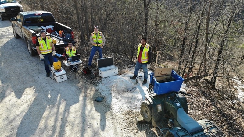
The non-invasive technology works similarly to ultrasound imaging. It is used to estimate the depth and stiffness of bedrock for new highway alignments and understand subsurface conditions that cause slope instability. Unexpected changes in bedrock depth near slopes can create pockets where water collects. Over time, this can cause the soil to become saturated and unstable.
Clint Wood, University of Arkansas civil engineering associate professor and a geotechnical engineer, sends stress waves into the ground and measures their response at the surface. He uses the results to create profiles of subsurface conditions and soil composition.
Highway designers and construction contractors previously relied on exploratory drilling and other imperfect methods for determining subsurface conditions.
The Arkansas Department of Transportation provided $561,427 in funding.