The Arizona Department of Transportation (ADOT) is espousing the benefits of a U.S. Geological Survey (USGS) partnership in aiding the department’s highway project planning efforts.
“With U.S. Geological Survey’s expertise in water science and hydrology, ADOT can now use these data to construct and maintain bridges and roadways that better reflect how the natural environment and highway infrastructure interact,” Steven Olmsted, program manager with ADOT Environmental Planning, said. “These data have already made a difference on numerous ADOT projects.”
ADOT’s collaboration with the USGS’s Arizona Water Science Center has helped engineers anticipate the effects of extreme weather on bridges and highways and design ways to handle it. The initiative has enhanced flooding, natural hazards, and weather-related risk use data through the Resilience Program.
“This partnership has also established a successful framework for collaboration between USGS and State DOTs, and is being adopted by many other USGS offices across the country,” USGS Arizona Water Science Center Hydrologist Brandon Forbes, said.
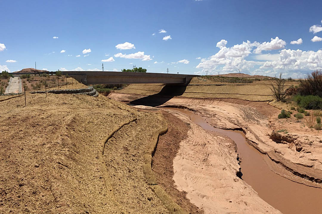
The partnership fostered improvements to the US 160 bridge spanning Laguna Creek on the Navajo Nation in northeastern Arizona three years ago, officials said, adding the endeavor in which the bridge’s abutments were protected by using gabion baskets to reduce meandering where the creek passes under US 160, won an award from Arizona State University’s Metis Center for Infrastructure and Sustainable Engineering.
The work was done in accordance with data on the volume and velocity of the creek’s flow to anticipate how the channel would change.